
Another big trough has positioned itself across the middle of the country bringing unseasonably cool air. While cooler than normal conditions will stick around for the remainder of the week, the core of cool air that at times made it south of the Hudson Bay this summer can be seen much further north this time around. Ultimately, that means the southerly flow will be able to return a bit quicker.
 |
| 500mb chart Wednesday morning showing large trough over eastern U.S., large ridge in western U.S. |
By late week, the upper level northwest flow will moderate and almost become zonal while low level south/southwest flow sets up. Low level south/southwest flow will bring an increase in temperatures and an increase in humidity and moisture. While temperatures Wednesday afternoon top off around 80˚, by Friday temperatures will be warming back into the upper 80's, a direct result of the low level south/southwest flow.
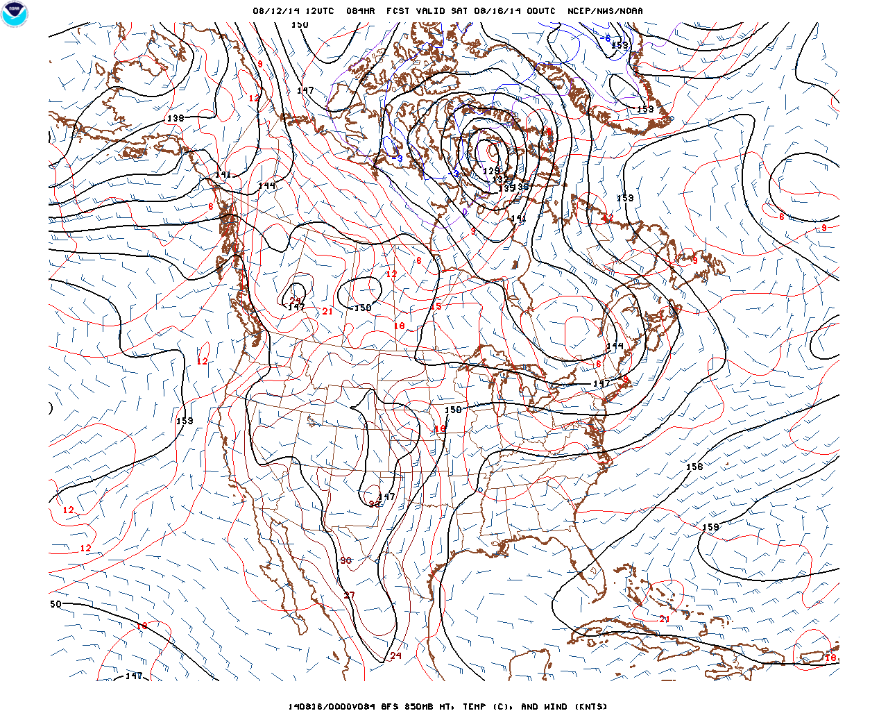 |
| Friday evening 850mb map. The south/southwest flow can be identified easily setting up over the Plains/Midwest. |

 |
| GFS Sunday morning. Result of upper level shortwave moving across the middle of the country. |
The Euro is much slower with the progression of the low, keeping the heaviest rain to the west throughout Sunday and bringing lesser amounts Monday and Tuesday as the low slowly moves east.

 |
| Euro Sunday evening. Low still hasn't tracked as far east as GFS shows Sunday morning. |
Last thought for the day: The long-range charts in the GFS show a large upper level ridge building across the eastern two thirds of the country later this month. This pattern is more seasonable for late summer and would result in above temperatures towards the end of August.
 |
| Wednesday August 26th 500mb map |
Those are some of the things we'll be watching over the next week or so. As always, thanks for reading.
-Nick
No comments:
Post a Comment